A Stroll Through the Pines: San Diego’s Middle Peak
- Share via
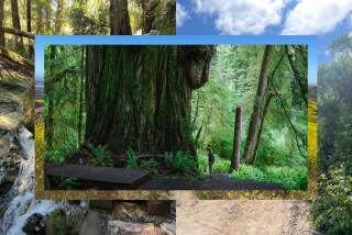
Middle Peak, in the middle of the Cuyamaca Mountains in San Diego County, is the place for a summer saunter if you like tall trees. Encircling the peak are big specimens of silver fir and cedar, plus Coulter, sugar, Ponderosa and Jeffrey pines.
The Cuyamacas’ geographical location between coast and desert makes these mountains an unusual ecosystem. The 4,000- to 6,500-foot peaks host rich conifer forests. Cuyamaca Rancho State Park protects much of the mountains, which are a delight for bird watchers because desert, coastal and mountain species are all found in the range.
Centerpiece of the park--and of the Cuyamaca Mountains--is a chain of three forested peaks: North, Middle and Cuyamaca. Cuyamaca Peak, at 6,512 feet, is the highest summit in the range and offers the best views. Most of North Peak (5,993 feet) is on private property. Middle Peak (5,883 feet) has the best trail network and the tallest trees.
The hike around Middle Peak uses several trails; one good path that ascends the north side of the peak is Sugar Pine Trail. Utilizing this trail and a couple of others, it’s possible to make several loops of varying distances around Middle Peak.
Directions to the trailhead: This hike begins at a parking area off California 79 in Cuyamaca Rancho State Park. The parking area is opposite the Boy Scouts’ Camp Hual-Cu-Cuisi. If you’re traveling California 79 south to the state park, the trailhead is about 10 miles from Julian. If you’re heading north on California 79, the trailhead is located 5 miles north of park headquarters and 1 1/2 miles north of the entrance to Paso Pichacho Camp/Picnic Area. The parking area is located at a nearly right-angle bend in the highway.
The end of the trail is easy to spot; it’s the road across from the parking area that leads through the Boy Scout camp. The unsigned beginning of the trail is more difficult to find. Look on the left (west) side of California 79 for a path that parallels the highway. Can’t find it? Walk 75 yards or so north up the highway, then head left, dip in and out of a roadside drainage ditch, and you’ll pick up the trail heading north.
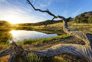
The hike: Minshall is the name of the unsigned trail that parallels California 79. Looking east, the most obvious geographical feature is Cuyamaca Reservoir. Before the dam was built creating the reservoir, Cuyamaca Lake, as it was called, was a sometime affair. Indians never trusted it as a dependable water source, and the Spanish referred to it as la laguna que deseco, “the lake that dries up.” During dry years like this one, there’s more meadow than reservoir.
After half a mile, the trail skirts Lakeland Resort and turns west. Signs inform you that you’re now on the way to Middle Peak and that you’re entering a state park wilderness area. Your path, a retiring dirt road now known as Sugar Pine Trail, begins ascending into the pines. At lower elevations, the pines mix it up with oak woodland.
A short mile’s ascent on Sugar Pine Trail brings you to a junction with Middle Peak fire road. If a 3-mile loop is plenty for you this day, turn left on the fire road and follow it down to the Boy Scout camp and the trailhead.
Otherwise, continue on Sugar Pine Trail past some fine specimens of Southern California’s largest native pine. The bark of these trees is reddish brown and deeply furrowed into scaly plates. Sugar pines have larger branches and cones than their somewhat similar-looking Middle Peak neighbors, the Ponderosa pines.
Nearing the halfway point of the hike, the trail passes the stone foundation ruins of an old cabin, turns southwest and comes to a signed junction.
You join Middle Peak Loop Road, which at first curves west, then heads south. Middle Peak itself is possible to ascend, but trees and shrubs prevent any kind of view of Cuyamaca country.
Middle Peak Loop Road descends out of the pines to Milk Ranch Road. Bear left on this dirt fire road, which crosses oak-dotted meadowland. You’ll get a feeling for the “rancho” part of the state park. The dirt road becomes gravel, skirts the Boy Scout camp and brings you back to California 79 and the trailhead.
More to Read
Sign up for The Wild
We’ll help you find the best places to hike, bike and run, as well as the perfect silent spots for meditation and yoga.
You may occasionally receive promotional content from the Los Angeles Times.


