Storm will bring rain and mountain snow to the Southland on Sunday

- Share via
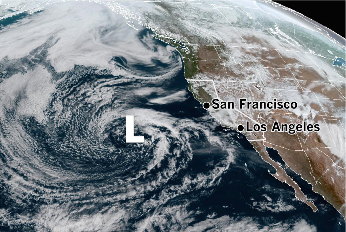
A low-pressure system is expected to bring rain across Southern California on Sunday, with gusty winds and mountain snow, the National Weather Service said.
Precipitation is expected to begin in Santa Barbara County and quickly spread to Ventura and Los Angeles counties, with much of the rain falling Sunday afternoon and into evening, then tapering off to scattered showers on Monday, said Tom Fisher with the National Weather Service in Oxnard.
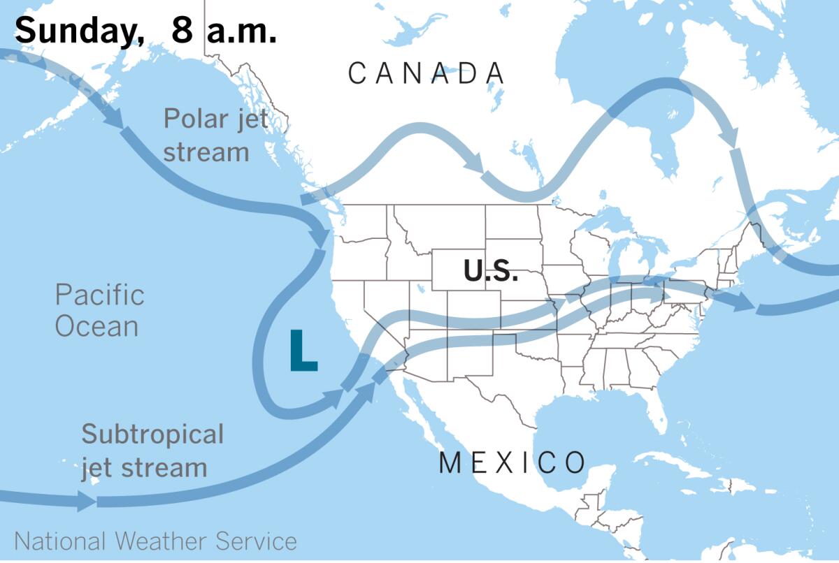
The system is fueled by a strong, upper-level jet stream moving through southwest California and providing instability. That, combined with moderate southerly flow at the lower levels of the atmosphere, will result in widespread rainfall of a half-inch to an inch in the coastal and valley areas, and 1 to 2 inches on coastal mountain slopes.
The jet stream-fueled instability will create a chance of thunderstorms, especially in Ventura and Santa Barbara counties, and will raise a risk of strong winds and brief heavy downpours, potentially accompanied by small hail. Dangerous cloud-to-ground lightning is also possible. Gusty south winds approaching advisory levels are widely expected, especially near the coast and in the mountains.
Mountain snow is not predicted to affect Interstate 5 over the Grapevine, but snow levels that will start at 6,500 feet will lower to 5,000 feet by the end of he storm. Accumulations of 6 to 10 inches are possible in the higher elevations. A winter weather advisory will be posted for the San Gabriel Mountains.

Hazardous driving conditions are possible with potential for roadway flooding.
Scattered showers will linger, especially in the mountains, on Monday as the low system moves away, and temperatures will hover below normal.
After that, low pressure dropping out of Alaska on Monday and stalling over Washington state through Tuesday will combine with high pressure over Mexico to set up a strong westerly jet stream over the the southern half of the U.S. This will probably cause increasing clouds and widespread chances for light rain, especially in the mountains and the Central Coast. Snow levels will remain around 5,000 feet.
The stalled low is expected to move to the south and east of Washington, but it’s too early to tell how far south and how much moisture will be associated with it. It is expected to be cold, however, and snow levels could dip to near 3,000 feet by Thursday. Gusty west to north winds would accompany the system Wednesday night through Friday.
An extended period of warmer, dry weather is expected to begin Friday and Saturday.
More to Read
Sign up for Essential California
The most important California stories and recommendations in your inbox every morning.
You may occasionally receive promotional content from the Los Angeles Times.


