Six- to 10-day outlook for L.A. region looks moist with normal temperatures
- Share via
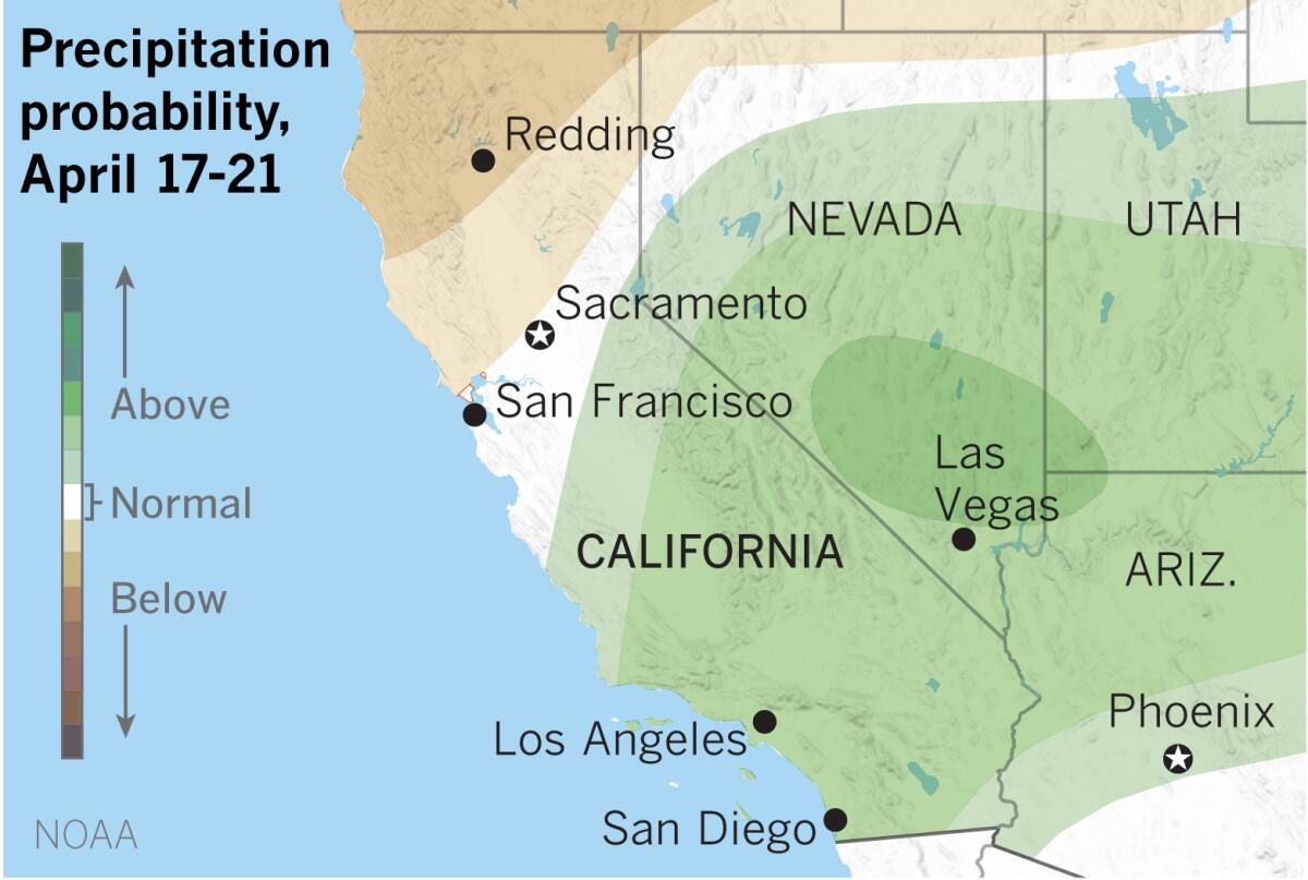
The outlook for April 17 to 21 calls for above-normal precipitation in the southern part of the state, according to the National Oceanic and Atmospheric Administration.
Temperatures in the southern half of the state are expected to be normal or slightly below during the same period.
Northern California, which has lagged on precipitation after a dry autumn, will see above-normal temperatures and normal or below-normal precipitation.
Recent rains have lifted Southern California reporting stations to normal or above normal for the season. For example, Los Angeles received 14.63 inches of rain from Oct. 1 through April 10, putting it at 106% of normal for the date. Bakersfield has received 119% of normal, and San Diego has gotten 140%.
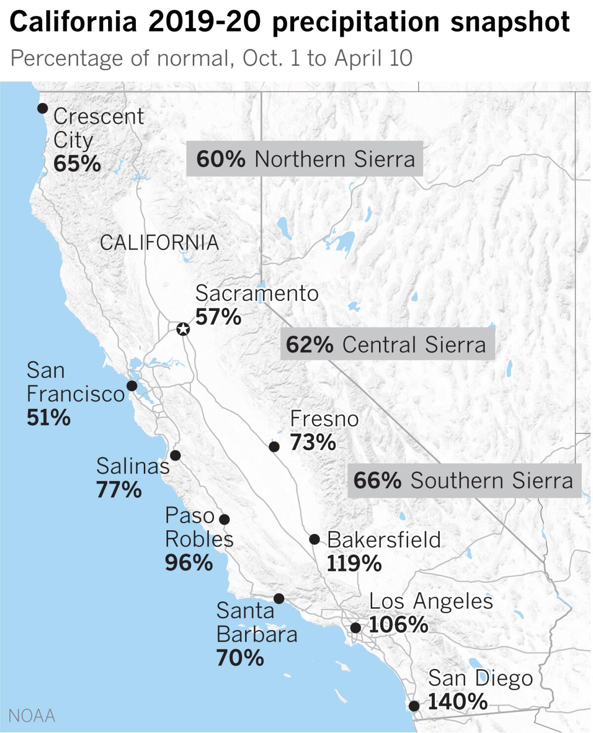
In the north, though, rainfall has been disappointing. San Francisco is at 51% of normal, and Sacramento is at 57%.
The Sierra Nevada indexes are all below normal, getting worse as you go northward. The critically important Northern Sierra 8-Station Index stands at 60% of normal. This is an area that boasts California’s biggest reservoirs and although the reservoirs are in good shape for now, the deficit does not bode well for groundwater and the fire season ahead.
The Central Sierra 5-Station index is at 62% of normal, and the Southern Sierra 6-Station Index is at 66%.
Snow in the high elevations of the Sierra stores water that is gradually released with the thaw, filling streams and reservoirs and replenishing groundwater.
More to Read
Sign up for Essential California
The most important California stories and recommendations in your inbox every morning.
You may occasionally receive promotional content from the Los Angeles Times.

