Atmospheric river will focus rain on Northern and Central California

- Share via
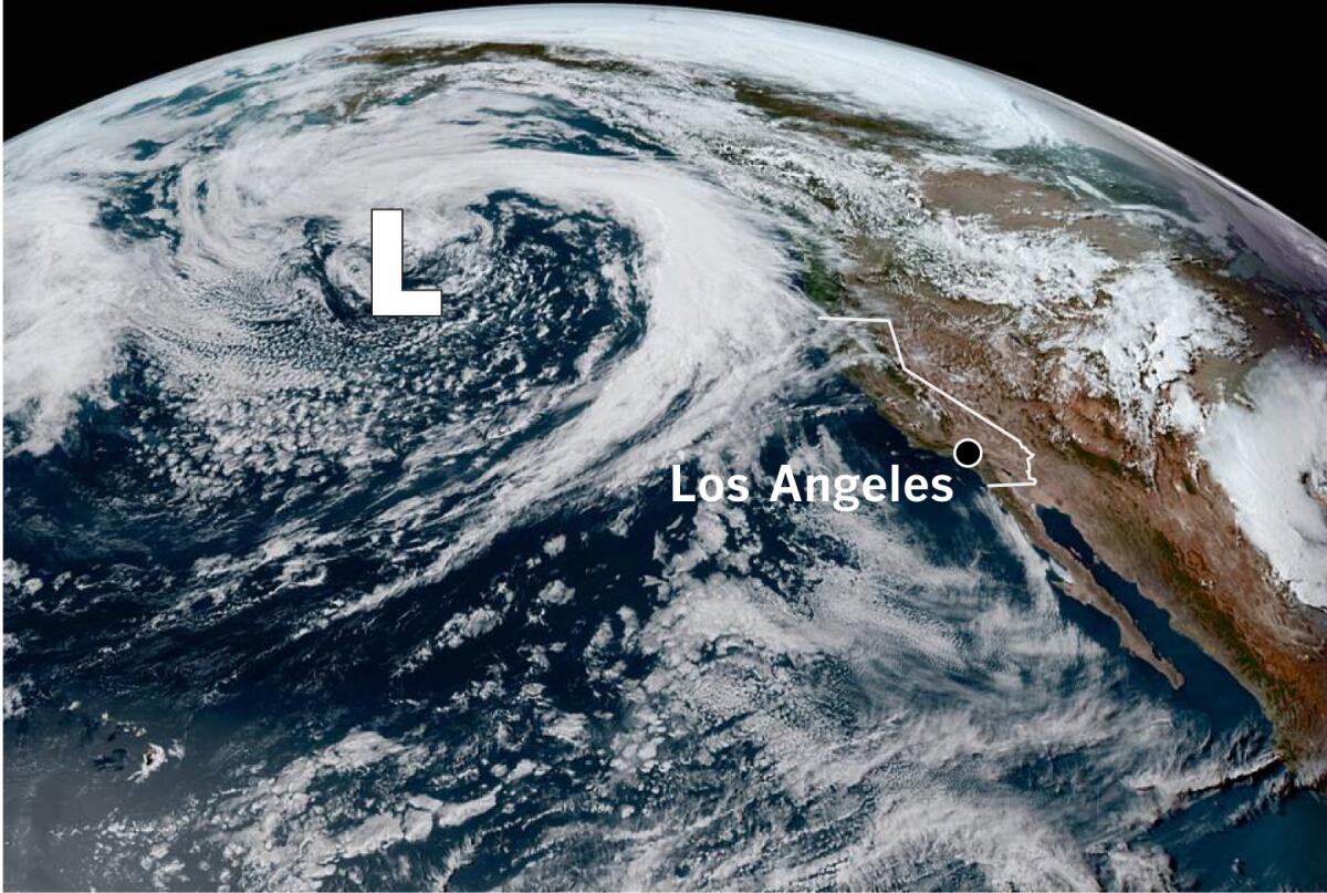
A deep low-pressure system that was about 1,000 miles west of Oregon on Friday will tap moisture originating in the subtropical Pacific and direct it toward Oregon and Northern California, the National Weather Service said.
The plume of moisture is predicted to be an atmospheric river at landfall, said F. Martin Ralph, a leading authority on atmospheric rivers and director of the Center for Western Water and Weather Extremes at the Scripps Institution of Oceanography.
Atmospheric rivers are long, narrow, concentrated bands of water vapor carried along by strong winds in the lower and middle levels of the atmosphere, and are usually seen during the winter. However, they are “climatologically uncommon for this time of year,” according to the National Weather Service.
An atmospheric river in May “is somewhat unusual,” Ralph said. The forecast for San Francisco calls for a 90% chance of at least a weak atmospheric river, and a 20% chance that it could be a moderate one, he said. Weak and moderate atmospheric rivers bring mostly beneficial rain and typically do not cause much damage. The frequency of such storms near San Francisco in May is about half of what is seen during the midwinter peak.
Atmospheric rivers can cause heavy rainfall, floods and mudslides. But there are essentially no extremely strong or exceptionally strong atmospheric rivers in the San Francisco vicinity by May.
Atmospheric rivers are roughly 250 to 375 miles wide. A strong one can transport from 7.5 to 15 times the amount of water that flows through the mouth of the Mississippi River.

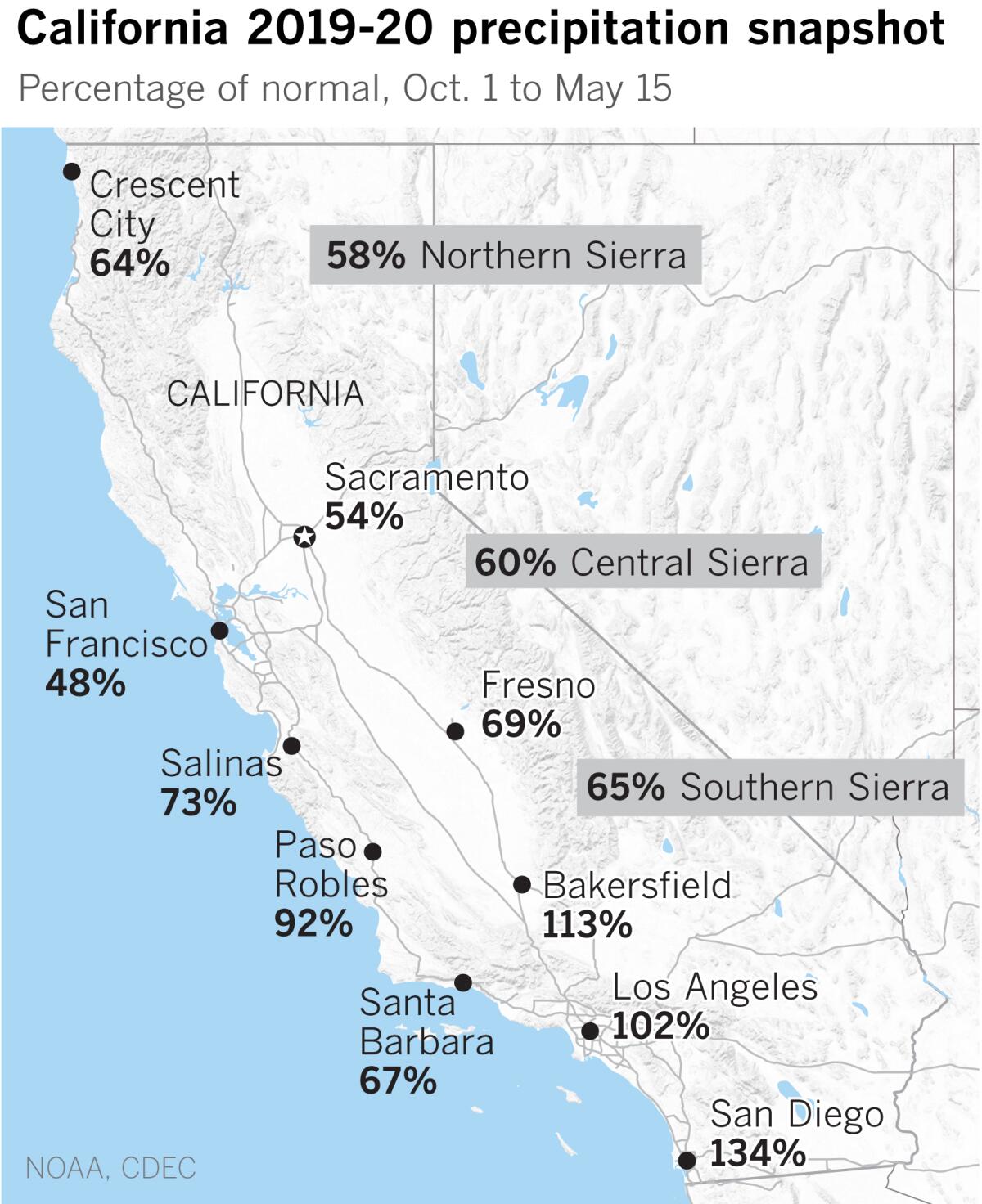
Northern California remains the part of the state where precipitation is most needed. Drought in Northern California, the Pacific Northwest and large parts of the West continues to expand.
San Francisco stands at 48% of normal for its water year. Rain is expected to start in the North Bay Area late Saturday afternoon and spread southward Saturday night into Sunday. Isolated thunderstorms are possible Monday and showers could linger on Tuesday with below-normal temperatures.
In Southern California, light rain is possible Sunday night and Monday, with the best chances north of Santa Barbara.
As UCLA climate scientist Daniel Swain points out, soaking rains and cooler temperatures in Northern California will ease the exceptional long-term dryness and bring a temporary reprieve from the early start of the wildfire season.
More to Read
Sign up for Essential California
The most important California stories and recommendations in your inbox every morning.
You may occasionally receive promotional content from the Los Angeles Times.


