Will a former hurricane provide the ‘great wet hope’ for the West Coast?

- Share via
Extended weather outlooks are providing some hope for fire-scorched Northern California.
Weather models are starting to show greater agreement on the possibility of moisture making its way into Northern California by the second half of next week, the National Weather Service said.
The weather service said that more details resulting in increased confidence in the forecast could emerge in the early part of next week.
“It looks like a dramatic dip in the jet stream pattern,” said climatologist Bill Patzert. “For much of the summer, the jet stream has shunned the West Coast, resulting in record temperatures from Seattle to San Diego. Next week it should dip southward into the Pacific Northwest and perhaps Northern California.”
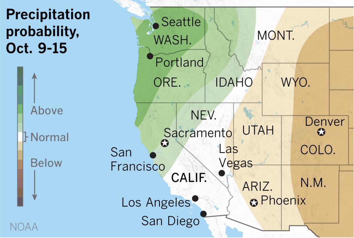
In addition, the National Oceanic and Atmospheric Administration’s precipitation outlooks covering the period from Oct. 7 through Oct. 15 favor above-normal chances of precipitation in Northern California.
Moisture from what is now Hurricane Marie may move into Central and Northern California next week. Marie was intensifying at about 15 degrees north latitude and 120 degrees west longitude, southwest of Baja California on Thursday afternoon. The storm was moving to the northwest and was expected to weaken in about 48 hours as it moves over cooler waters.
By next week the remnant of the storm would be a cutoff low, which would make its movements hard to predict.
“The great wet hope for the West Coast is the interaction between remnants of Hurricane Marie and the cold jet stream coming out of the North Pacific,” Patzert said. Forecasters will be watching developments in the days ahead. “Even if it doesn’t bring rainfall, it will drop temperatures and increase humidity to the delight of firefighters,” he said.

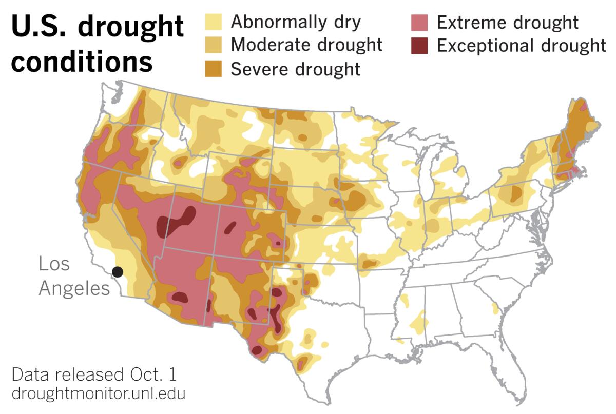
As the most recent U.S. Drought Monitor data released Thursday indicate, extreme drought expanded in parts of Northern California and neighboring states. So if any rain falls, it would dampen areas that could really use the relief, especially with major fires still burning and red-flag fire warnings posted from north of the San Francisco Bay Area to the Central Coast.
Elsewhere in the West, the Drought Monitor reported new areas of exceptional drought appearing or expanding in Arizona, Colorado, New Mexico and Utah.
The monsoon season in the Southwest ended in record territory. For example, in Tucson, 6.08 inches of rain would be normal for the season from June through September. This year, only 1.62 inches fell. That makes it the second-driest monsoon on record.
The movement of the jet stream should push high pressure over the Great Basin farther east. “Don’t expect much relief in the bull’s-eye of the drought,” Patzert said, referring to the extremely dry areas of the Southwest near the Four Corners.
The shift in the jet stream provides a glimmer of hope for the West Coast.
“At a minimum, it will be a taste of fall and a welcome relief from all the hot, dry weather news of the last three months,” Patzert said.
More to Read
Sign up for Essential California
The most important California stories and recommendations in your inbox every morning.
You may occasionally receive promotional content from the Los Angeles Times.


