Two fast-moving California fires are creating their own dangerous weather systems

- Share via
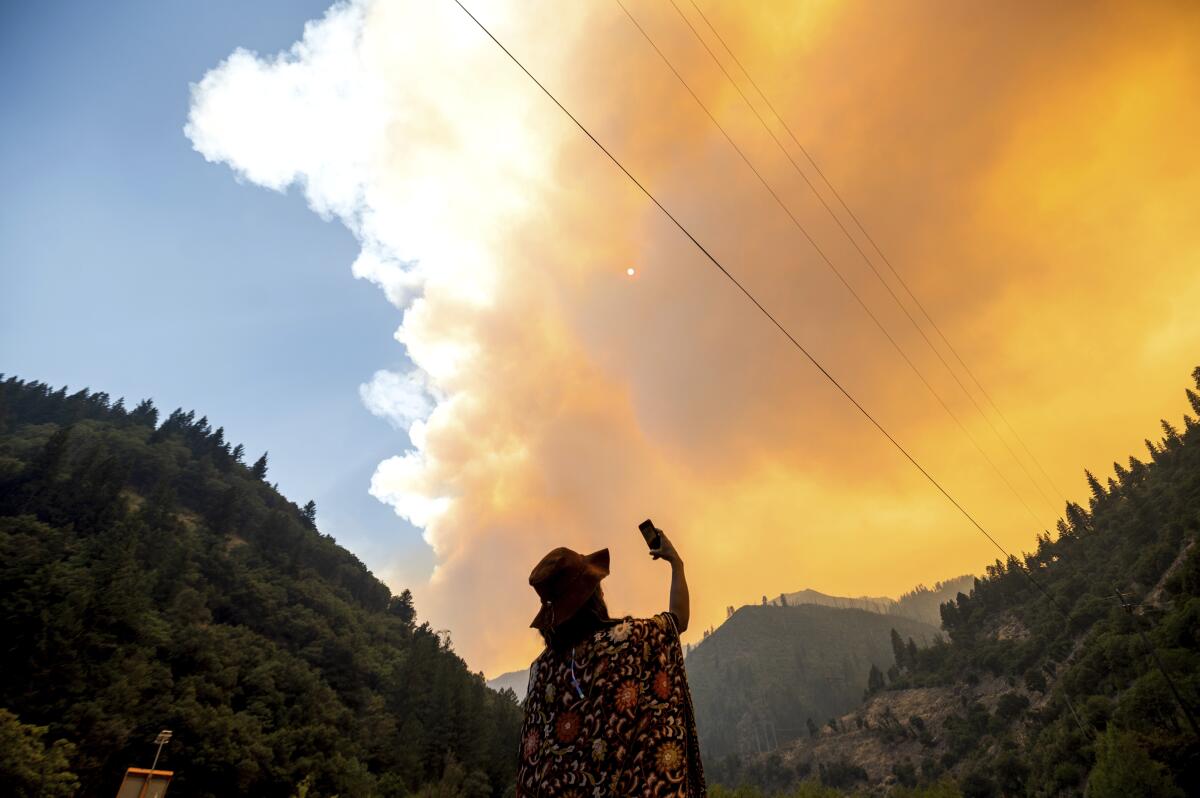
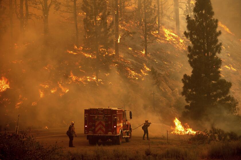
A pair of fast-moving wildfires in California have chewed through nearly 100,000 acres while spewing noxious smoke, generating pyrocumulus clouds, lightning and other dangerous weather conditions and adding to the state’s growing wildfire misery.
Northern California has been hit hard by a series of big wildfires this summer, with officials alarmed by the number of blazes that have broken out so early in the season. California already is outpacing last year’s fire season as climate change is allowing blazes to spread faster and the terrain to burn more quickly.
Exhausted firefighters had hoped for a reprieve after battling several forest fires — including one that burned through the small town of Doyle — worsened by a summer heat wave that has baked the Pacific Northwest and the upper reaches of Northern California.
But two new fires have raged out of control over the last few days, creating a new fronts of battle.
“Right now,” said Tamarack fire incident spokesman Mike DeFries, “there’s a lot happening all at once.”
PG&E reported the information to the California Public Utilities Commission, noting that blown fuses and a tree may have contributed to the Dixie fire.
The 5-day-old Dixie fire spanning Butte and Plumas counties has stymied fire crews as it continues to swell — doubling in size to roughly 60,000 acres Tuesday with only 15% containment, according to the California Department of Forestry and Fire Protection.
Pacific Gas & Electric said its utility equipment may have sparked the fire after an electric worker found two blown fuses and a tree leaning onto a power line conductor in the area near the ignition point of the blaze.
The fire Monday grew so volatile that it generated its own pyrocumulonimbus cloud, which created its own lightning, said Scott Rowe, a meteorologist with the National Weather Service in Sacramento.
The vertically growing clouds are unstable and intensely hot, he said, noting that “they are dangerous on multiple fronts, mainly because there’s potential that you could see lightning develop underneath the fire, and that in itself could spark new fires.”
Lightning played a huge role in the state’s record-breaking fire season last year, and wildfire experts have said that similar patterns could play out in 2021 if conditions repeat themselves.
“You definitely would not want to find yourself near one of these,” Rowe said of the cloud.
But that’s precisely what fire crews are up against, said Rick Carhart, a spokesman for Cal Fire’s Butte County unit.
“The last two days, we’ve had some pretty significant weather,” Carhart said. “That [cloud] caused some extreme fire activity, which basically made our firefighters back off from what they were doing until the weather calmed down.”
Firefighters have done a good job of steering the flames away from the site of the 2018 Camp fire, which ravaged the nearby town of Paradise, he said. But it is now moving in the direction of Lake Almanor, where there are other homes and cabins.
Evacuation orders across portions of Butte and Plumas counties remained in place Tuesday, officials said.
Crews are working against steep slopes and nearly impassable terrain, Carhart said, especially since the fire is far from roads that would allow easy access with engines and hoses.
“In this case, we’re hiking miles in and doing a lot of the work with tools instead of water because we can’t even get water in there in some of these places,” he said.
And as the fire continues to expand, an increasing number of personnel are turning their focus to the aggressive blaze.
“We are still bringing in more resources,” Carhart said, “because this thing just keeps growing on us.”
Multiple fires in Northern California increased in size and threatened communities on Monday, with the worst two being the Dixie and Tamarack fires.
Meanwhile, the Tamarack fire near the California-Nevada border in Humboldt-Toiyabe National Forest ballooned in size overnight, from 23,000 acres to nearly 40,000 Tuesday morning with 0% containment, according to the U.S. Forest Service.
The aggressive, lightning-sparked fire spurred mandatory evacuation orders from Markleeville to Mesa Vista, with the Alpine County Sheriff’s Office posting on Facebook that officials had no electricity and were doing their best to get information out to threatened residents.
More than half of the county’s residents remained without power Tuesday, officials said, even as the California Department of Transportation closed State Highway 88 from Picketts Junction to the Nevada state line because of the fire.
The fire is expanding with such force that it, too, is beginning to generate its own weather, fire incident spokeswoman Tracy LeClair said. On Tuesday morning, a large pyrocumulonimbus cloud could be seen forming over the blaze.
“As the heat from the fire builds, that heat rises, and it begins to suck the surrounding air up with it,” LeClair said, “and then all of that lofts upward. That’s when you start to see these clouds.”
Smoke from the fire has also darkened the skies in the nearby South Lake Tahoe area, while Markleeville on Tuesday morning had an “unhealthy” air quality reading of nearly 200, according to EPA air monitoring site AirNow.Gov.
The smoke is posing a challenge for firefighters, said DeFries, the Tamarack fire incident spokesman, as it is making air operations and accurate mapping difficult.
More than 1,000 firefighters are battling the flames, but, as in the Dixie fire, many are contending with steep, rocky terrain at elevations as high as 7,000 feet.
Crews on Tuesday were prioritizing the fire’s northeast corner in an attempt to keep the blaze west of Highway 395 and away from homes and structures, he said.
But firefighter safety is also a concern, DeFries said, as the erratic flames meet “super-dry” piñon-juniper woodlands and hotly combustible grasses.
“A lot of the terrain is not in a location where you can necessarily send in groups of firefighters to try and create traditional lines,” he said. “You’ve basically got to fight it where you can.”
More to Read
Sign up for Essential California
The most important California stories and recommendations in your inbox every morning.
You may occasionally receive promotional content from the Los Angeles Times.


