The heat is on: Warm weather on tap this week in Southern California

- Share via
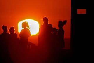
A warming trend has made Southern California among the hottest places in the country, and more unseasonable weather is expected this week, officials said.
By midweek, temperatures are expected to climb into the mid-80s in many valley and coastal areas, “where most people are not accustomed to this type of winter heat,” the National Weather Service said. The peak heat will occur between Wednesday and Friday.
At least one daily record was broken when Anaheim on Sunday soared to 85 degrees — the hottest temperature in the nation, officials said. Southern California again had the highest temperature in the U.S. on Monday when Camp Pendleton hit 84 degrees.
Downtown Los Angeles on Monday recorded a high of 76 degrees, Burbank hit 79, and Long Beach, 80. David Sweet, a meteorologist with the weather service in Oxnard, said temperatures will reach the upper 80s by Thursday and Friday.
Sweet said normal high temperatures for this time of year are around 68 degrees, “so 88 would be 20 degrees above normal.”
An excessive heat watch will be in effect for much the Los Angeles Basin and coastal valleys from 11 a.m. Wednesday through 6 p.m. Friday, according to the weather service’s L.A. office.
There is a bit more uncertainty about the forecast for the weekend, but officials currently predict that Super Bowl Sunday in Inglewood will top 80 degrees as well.
Officials warned that the week’s temperatures could feel especially abnormal for out-of-town visitors — of whom some 150,000 are expected in the days surrounding the big game.
“Be prepared for signs of dehydration and exhaustion, which could lead to heat stress during the hottest part of the day, or if for prolonged outdoor exposure and exercise,” the weather service said.
The unusual February heat is being driven by a ridge of high pressure, or a “dome of warm air that’s going to be sitting over southwest California,” Sweet said.
Also on tap are Santa Ana winds, which were expected to persist into Monday afternoon, with additional strong winds possible through the week, he said.
The strongest winds will occur in the Santa Monica Mountains and other mountain ranges in Los Angeles County, with gusts over 60 mph at times.
“These offshore winds make it very warm and very dry,” Sweet said. “Then you add this ridge of high pressure on top of it, and that’s why the combination is pushing our temperatures to near-record levels.”
The hot, dry forecast is particularly worrisome on the heels of the state’s second snow survey of the season, which found that unseasonable conditions have already contributed to a couple of inches of snowmelt and a lack of snow accumulation this year. Snowpack traditionally supplies the state with about a third of its water.
But above-normal temperatures and below-normal dryness are slated to linger in California for the next week if not longer, according to the latest outlook from the National Weather Service Climate Prediction Center.
The forecast is a stark contrast to conditions on the east side of the country, where residents are recovering from a blizzard and are expected to see below-normal temperatures for at least the next six to 10 days.
And though December’s rains improved wildfire conditions by creating some wetter vegetation, there is still the potential for brushfires because of the warm, dry and windy condition this week, officials warned.
Residents are advised to use extra caution with flammable materials and also be on the lookout for wind hazards such as downed tree limbs and power lines.
There is some relief on the horizon, however. Cooler temperatures are expected to return to the Los Angeles area next week, Sweet said.
More to Read
Sign up for Essential California
The most important California stories and recommendations in your inbox every morning.
You may occasionally receive promotional content from the Los Angeles Times.


