California is so hot and dry that not even soaking rain can ease fall fire peril
- Share via
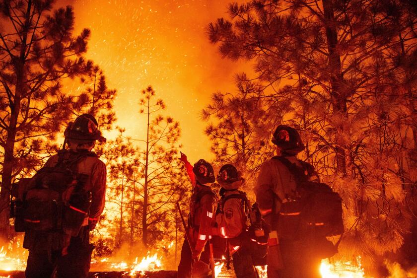
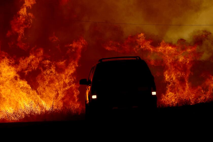
A summer of drought, extreme heat and deadly wildfires will end with much-needed rain this week in parts of California, but it is unlikely to douse the threat of wind-driven fires this fall in a state scarred by record-setting heat waves and bone-dry landscapes.
Although recent rains helped tame some of the state’s most active blazes — including the Mosquito fire in El Dorado and Placer counties and the Fairview fire in Riverside — it’s too soon to declare fire season over, experts say. In California, occasional bouts of heavy precipitation are proving outmatched by rising temperatures and worsening drought, which can leave vegetation nearly as brittle and fire-prone as it was before the rain.
What’s more, fall is often accompanied by gusty Santa Ana winds that help to fan wildfires. With experts now predicting a rare, third consecutive year of dry La Niña conditions, the combination of winds and desiccated fuel could prove perilous.
“We still have to be really vigilant,” said Alex Hall, director of the Center for Climate Science at UCLA. “The heart of the fire season — especially for Southern California and the central part of California — is coming up.”
Rain showers that started Sunday afternoon are bringing welcome moisture to the Mosquito fire, but also an increased risk of mudflows and floods in a heavily forested corner of Northern California.
More than 6,400 wildfires have seared the state this year, with several paths of death and destruction. Nine wildfire fatalities have been reported, and nearly 900 structures have been damaged or destroyed, according to the California Department of Forestry and Fire Protection.
While the end of fire season has long been a race between wind and rain, the state’s extreme heat and drought are dismantling that association.
Hall said the recent storms likely weren’t wet enough to be season-enders — especially because they coincided with a record-setting heat wave. Tropical Storm Kay, which dropped about 5 inches of rain in parts of San Diego County but less than 1.5 inches in the Los Angeles area, arrived at the end of a week of triple-digit temperatures.
“It was so little rain in the scheme of things — not enough to saturate the root zone, not enough to rehydrate the plants,” Hall said, adding that the extreme heat served to evaporate much of that water from the landscape.
“I would say we’re pretty much back to square one, as if that didn’t happen,” he said. “It just wasn’t enough, and we’re still losing a lot of whatever water did come in.”
Northern California has fared slightly better, with a big storm this week dropping between 2 and 4 inches of rain across portions of the North Bay coastal ranges and Santa Cruz Mountains. The system also delivered some precipitation further south as it moved through San Luis Obispo and Santa Barbara counties.
But California is deep into a third year of drought, and fuel moisture levels — the amount of moisture in the vegetation — remain low, according to Jon Heggie, a spokesman with Cal Fire.
“One storm does not change the threat in California,” Heggie said, adding that the agency needs “a series of storms and a pattern of continual rain” before it can reduce staffing from the current peak levels.
However, he said, rain can limit the potential for large fire growth, as it did with the Fairview and Mosquito fires, as well as the McKinney fire in Siskiyou County and Radford in San Bernardino County.
But while rain can moisten light fuels, such as grass, heavier fuels, including brush and chaparral, take substantially longer to retain water and typically have low moisture levels until spring, according to Heggie. He cautioned against using the label “fire season” in California.
“It’s a fire year,” he said.
As the state’s wildfire death toll rises to nine, some are urging a new focus on alert systems.
Henry Narvaez, a spokesman with the Los Angeles County Fire Department, agreed that dryness remains a top concern. The duff — needles, branches and other plant detritus — is 2 to 3 feet deep in some parts of the Angeles National Forest, he said.
“Even with the rains that we just had in the last few weeks, and then the ones that we’re anticipating, we still wouldn’t have enough rain to rid us of the dry vegetation, the dry brush, the dry trees, the dry duff,” he said.
The heat wave that kicked off September dried that material even further, so “all it’s waiting for is a small bit of ash to come floating by” to ignite a conflagration, he said.
Narvaez and other officials across the state are bracing for another potential hazard: the arrival of annual winds in late September and early October. In Southern California, Santa Anas that come from the Four Corners region and blow toward the ocean are known to contribute to dangerous fire spread.
“It’s very difficult to stop a fire that’s being progressed forward by Santa Ana winds,” Narvaez said. “That’s the other concern that we have — how bad of a Santa Ana season are we going to have, and how bad are the winds going to be?”
Last October, another regional pattern known as Sundowner winds helped fuel the 17,000-acre Alisal fire in Santa Barbara County. In the Bay Area, winds known as Diablos have contributed to dangerous fire spread.
Narvaez said department officials are forecasting a “near normal” amount of Santa Ana wind events and red flag days, as well as above-normal temperatures and below-normal rainfall through December.
“As it pertains to the dryness, we all know that it could rain for the next week, and it won’t do what we need it to do for the hillsides: get them back growing, get them back green,” he said. “We’re years behind where we should be, and as the months go by, it just gets drier and drier.”
Showers have been dampening parts of California since Sunday, with 3 to 4 inches falling in the Santa Barbara County mountains.
Fire officials are also keeping an eye on La Niña, a climate pattern in the tropical Pacific that is often associated with dry conditions in Southern California. There is a 91% chance that La Niña will stick around through at least November, according to the National Weather Service’s Climate Prediction Center.
However, La Niña sometimes splits California in two — bringing rains to the northern part of the state and dryness to the south, forecasters said. But UCLA’s Hall noted that there have been “plenty of wet years that are also La Niña years” in Southern California, so there are a range of possible outcomes.
Though the arrival of rains typically “shuts off” fire season in California, that hasn’t been the case in many places this year. As a result, fire risk remains high, especially with the looming threat of the Santa Anas in Southern California.
“There’s this moment when we have these really high winds blowing over this desiccated landscape that experienced a whole summertime of no precipitation,” Hall said. “That’s the recipe for extreme fire risk, and we’re entering that season right now.”
More to Read
Sign up for Essential California
The most important California stories and recommendations in your inbox every morning.
You may occasionally receive promotional content from the Los Angeles Times.
