Many of the world’s water basins are being depleted, studies find
- Share via
More than a third of the largest groundwater basins in the world are being depleted faster than they are getting replenished, and there are little to no accurate data showing just how much water is left in them, according to two new studies published Tuesday.
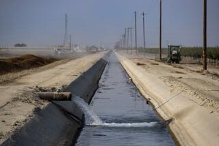
Researchers used data from NASA satellites to examine the 37 largest aquifers in the world. They found that eight were being depleted with almost no natural replenishment and five, including the Central Valley, were “extremely” or “highly stressed,” with not enough water flowing back to offset how much is sucked up. Saudi Arabia, India, Pakistan and northern Africa have the most stressed aquifers, according to the research.
FOLLOW ALONG: We’re on a roadtrip through drought-stricken California >>
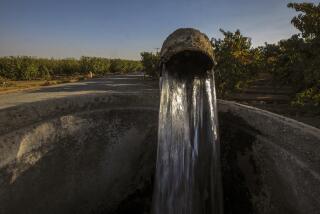
The studies spotlight increasing sustainability concerns as regions like California rely more and more on groundwater during times of severe drought.
“We know we’re taking more than we’re putting back in — how long do we have before we can’t do that anymore?” said Alexandra Richey, who conducted the studies as a graduate student at UC Irvine. “We don’t know, but we keep pumping. Which to me is terrifying.”
Many previous studies of groundwater storage relied on statistical calculations and looked mostly at how much water was being pumped from the ground. These limited estimates were too uncertain to improve groundwater management, researchers said. For example, past storage estimates for the Northwest Sahara Aquifer System ranged from 10 to 21,000 years.
“This work clearly demonstrates that it is no longer adequate to continue citing decades-old … estimates of total groundwater storage,” according to the new studies, which were published in the journal Water Resources Research.
Richey’s studies use 11 years of data from NASA satellites and include a number of other factors, such as population, climate and how people use water.
The twin satellites — known as Gravity Recover and Climate Experiment, or GRACE, satellites — orbit the Earth and measure the gravitational pull of water over time. The difference in measurements over time shows how much water the aquifers are gaining or losing.
The researchers said the world’s groundwater reserves are probably far smaller than previously thought.
The satellite data are just a start, Richey said. Only extensive, on-the-ground research and drilling can determine just how much groundwater an aquifer might have.
Jay Famiglietti, senior water scientist at NASA’s Jet Propulsion Laboratory and a UC Irvine professor, said that aquifers should be studied and valued the same way as precious oil reserves. “We need to drill for water the same way that we drill for other resources,” said Famiglietti, who worked on both of the studies.
Doing this isn’t easy, researchers acknowledged. Groundwater basins usually are located in deep, thick layers beneath the earth’s surface, making it costly — and challenging — to drill down to bedrock to find out just how deep the water goes. In drier regions, the groundwater could be as deep as 2,000 feet. “We have the technology, but we need the resources to do this exploration,” Richey said.
“We continue to pump in regions like the Central Valley without knowing how much water is in storage,” Richey said. “We need more study. We need better management.”
Richey’s research team included co-authors from NASA, the National Center for Atmospheric Research, National Taiwan University and UC Santa Barbara.
Twitter: @RosannaXia
More to Read
Sign up for Essential California
The most important California stories and recommendations in your inbox every morning.
You may occasionally receive promotional content from the Los Angeles Times.


