Trump’s budget would kill a crucial piece of a global tsunami warning system, sparking alarm in California and beyond

Trump’s proposed budget threatens to cut its funding for a tsunami warning system. (July 11, 2017)
- Share via
In 1964, a tsunami at least 20 feet tall slammed into Crescent City, Calif. The floodwaters came without a detailed warning, killing 11 people who did not get out in time.
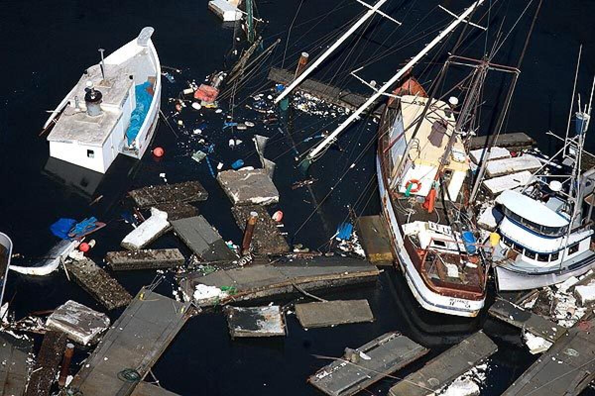
In 2011, another tsunami hit the town, located at the northern edge of the California coast. This time, officials had hours of warning that allowed them to evacuate areas along the coast before the tsunami hit, which destroyed much of Crescent City’s harbor.
The big difference? A tsunami detection system completed in 2008 that gave U.S. officials an accurate forecast of how big the tsunami would be as it hit America’s shores and when it would arrive.
But now, the $12-million system is under threat. President Trump’s proposed budget for the next fiscal year would end funding to operate the network, which would eventually shut it down. A House of Representatives subcommittee is expected to release details of its own version of the budget this week.
Forecast errors prompted invention of tsunami ocean sensors
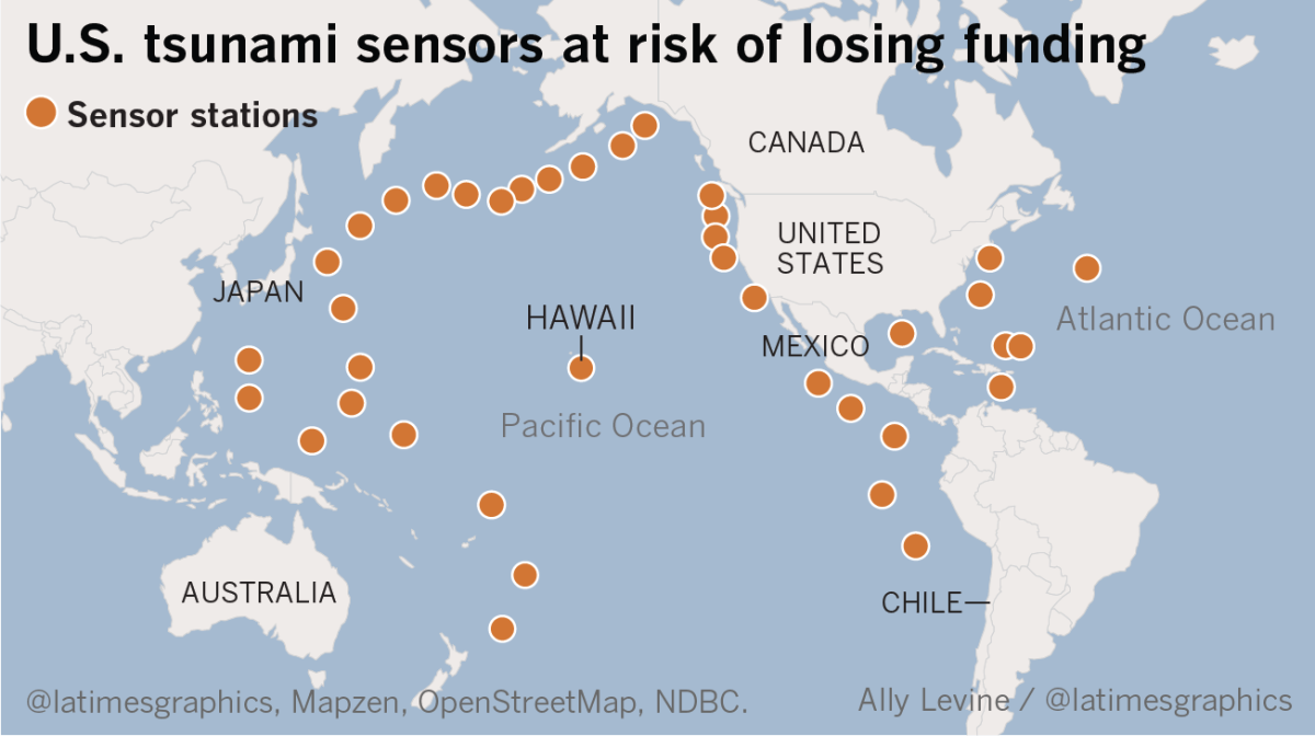
The system is made up of 39 sensors installed on sea floors around the world and tethered to floating buoys that communicate with the nation’s two tsunami warning centers by satellite. It was built after a false tsunami alert in 1986 caused a costly, unneeded evacuation of Honolulu’s famed tourist district, Waikiki, trapping cars in the evacuation zone and costing the state tens of millions of dollars.
Trump’s budget would also reduce the number of tsunami warning centers from two to one and slash staffing from 40 full-time employees to 15 — saving $11 million. And there’s a proposal to end $6 million in grants given out to states to reduce tsunami hazards, which fund emergency drills and the drawing of flood maps and evacuation plans.
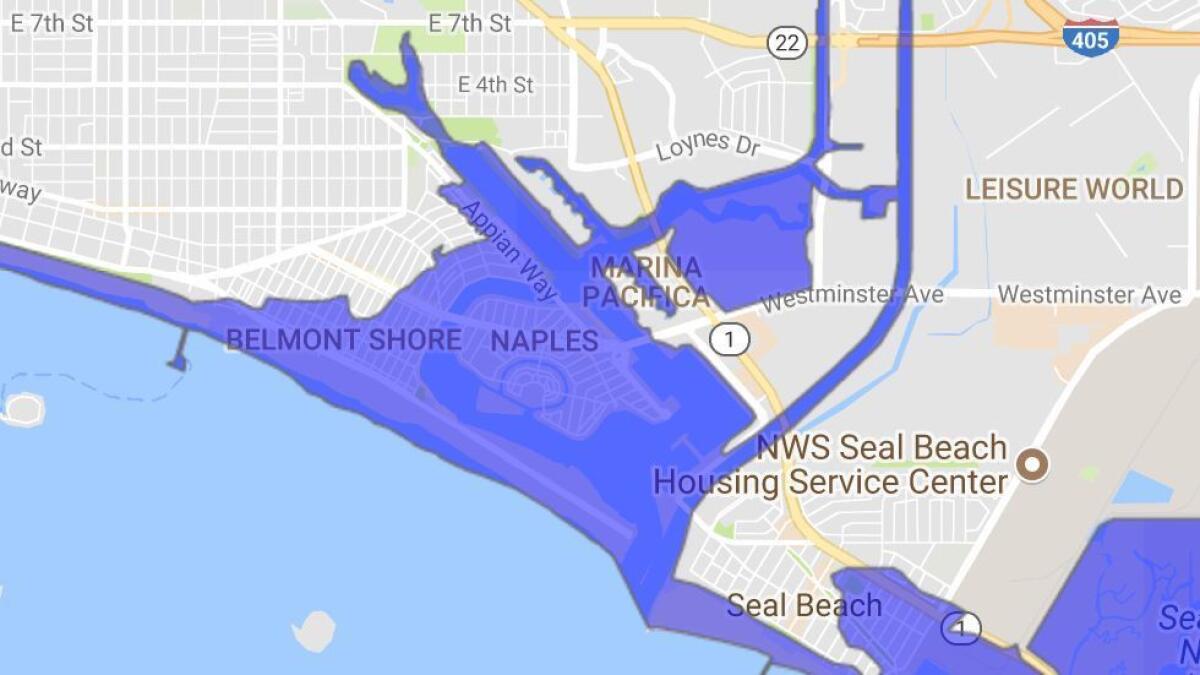
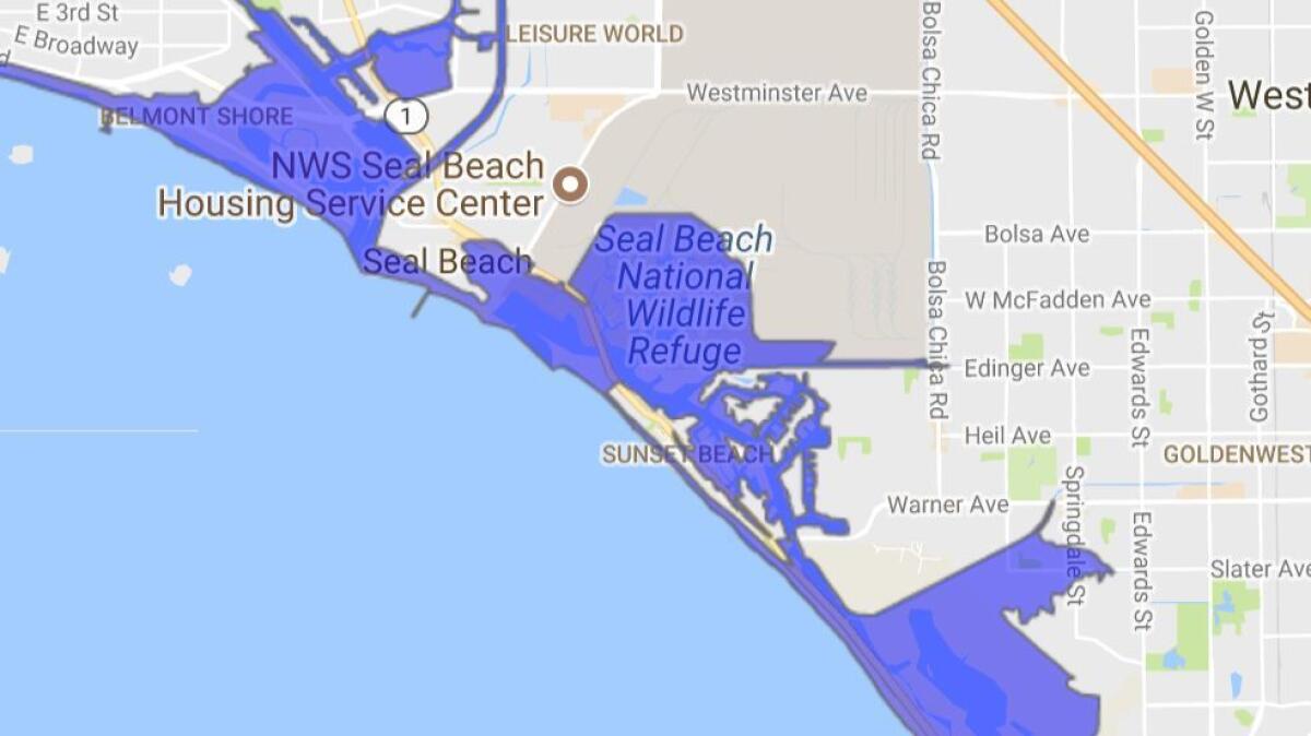
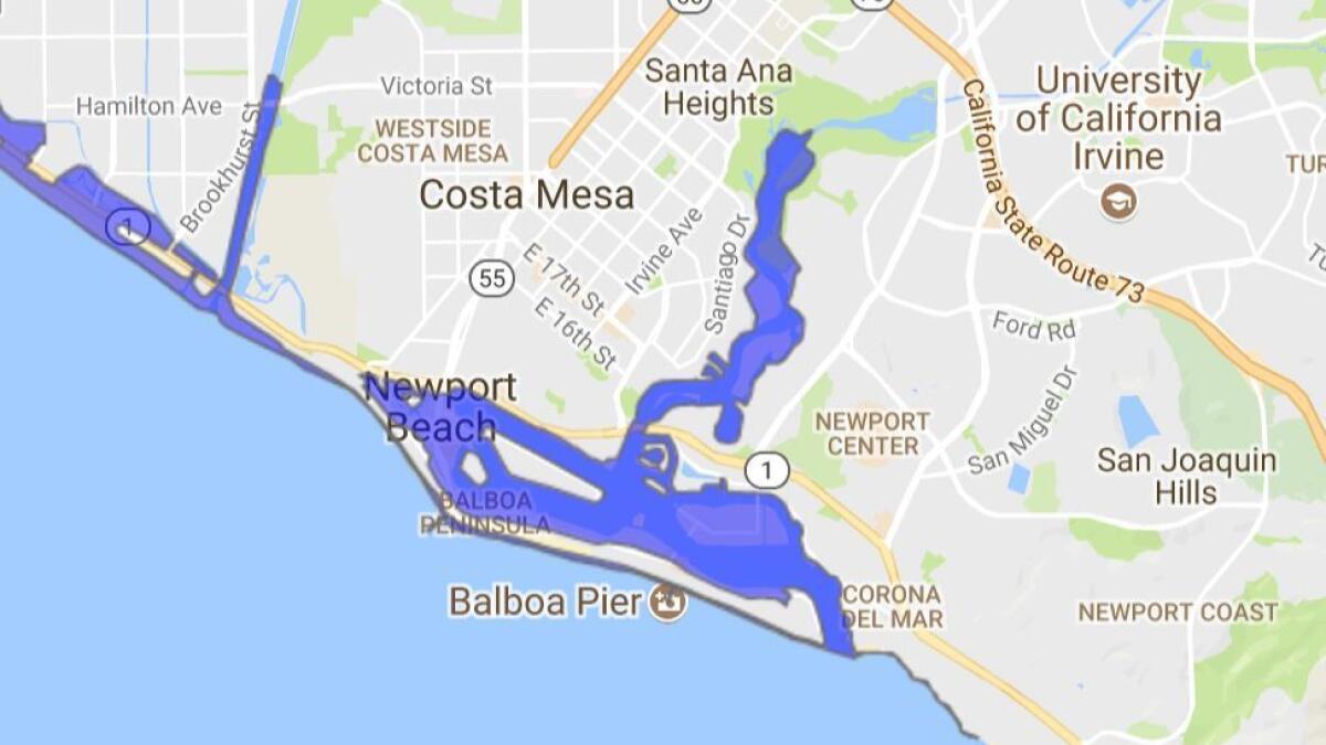
The proposed cuts come at a time when scientists are becoming more concerned about the damage potential from a huge West Coast tsunami. A government report published in 2013 found that a hypothetical magnitude 9.1 earthquake off the Alaska coast could produce a tsunami flooding areas of California where nearly 92,000 people live, including areas of Long Beach and San Diego, low-lying areas of southern L.A. and northern Orange counties, and coastal areas of San Francisco, Marin, Alameda, and Santa Cruz counties, along with the Crescent City area.
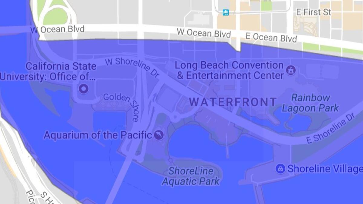
If a tsunami came during summer months, more than 1 million visitors could be on California’s beaches and coastal parks. Officials have warned that it could be difficult to evacuate islands with limited exits.
Indian Ocean tsunami prompted new generation of tsunami sensors
It was the 2004 tsunami in the Indian Ocean, which killed more than 235,000 people, that underscored the dangers of an inadequate tsunami warning system.
At the time, the United States had only six first-generation deep-ocean tsunami sensors installed — all close to the western coasts of the Americas. Seismologists detected the magnitude 9.1 earthquake in the Indian Ocean and surmised a tsunami was possible. But there were no deep-ocean tsunami sensors in the Indian Ocean. No warning went out.
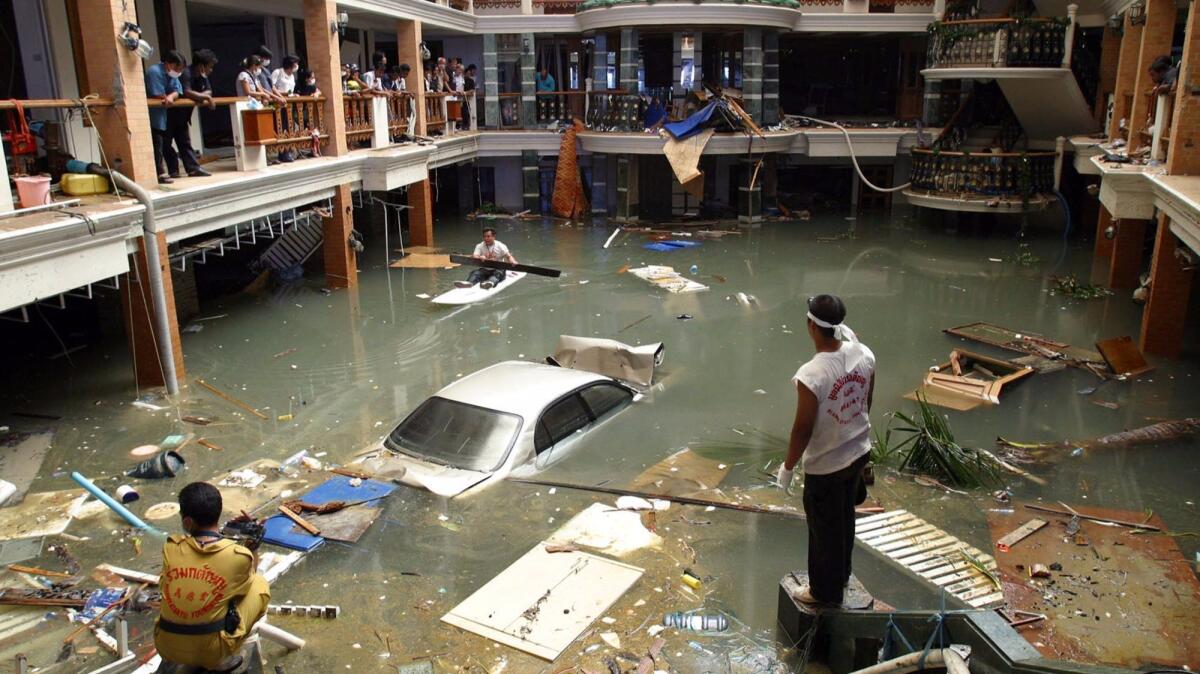
The disaster led President George W. Bush and Congress to back the creation of a U.S.-led global tsunami sensing system, which provides warnings of floodwaters sent by distant earthquakes. Besides the 39 second-generation deep-ocean buoys owned and operated by the U.S. National Oceanic and Atmospheric Administration, there are now 21 other sensors operated by eight other nations.
Ocean sensors produced accurate tsunami warnings
By the time the magnitude 9 earthquake struck off the Japanese coast in 2011, the deep-ocean tsunami sensing system, known as DART, worked quickly and accurately — for Americans. Hawaii was given many hours of warning, and time for evacuations, before tsunami waves flooded homes and damaged a harbor in Kahului, Maui.
The forecast for Crescent City in 2011 proved precise — the forecast wave height for that city was 8.2 feet, and the actual wave was 8.1 feet, according to the California Geological Survey.
Faulty tsunami forecast system in Japan
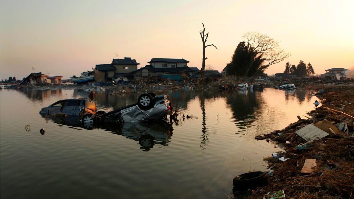
But while the deep-ocean tsunami network worked for America, Japan’s forecasting system woefully fell short.
The Japanese tsunami warning system and the general public expected a far less severe tsunami than the giant waves that actually rolled onto the shoreline from the magnitude 9 earthquake in 2011, according to Eddie Bernard, a former director of the U.S. Pacific Tsunami Warning Center.
If Japanese officials were using the American deep-ocean sensor data, Fukushima, home to the nuclear power plant that suffered a meltdown after floodwaters poured in, would have had 20 minutes’ warning that the tsunami would overtop the seawall, Bernard said.
The Japanese government has since invested heavily in deep-ocean tsunami sensors, spending $500 million to install 200 sensors off its coast, Bernard said.
Lessons from a Hawaiian tragedy
Deep-ocean sensors can also detect major tsunamis when the earthquakes that produce them are surprisingly relatively small. In 1946, an earthquake that occurred in Alaska wasn’t thought to be capable of producing a major tsunami. The main Alaskan coastline saw no rising floodwaters.
But a surprise tsunami quickly destroyed a desolate Coast Guard lighthouse in the Aleutian Islands before word could get out about the catastrophe.
Hours later, floodwaters struck Hawaii, killing 159 people, including about 20 elementary school children and teachers in one town alone. No warning was issued.
Scientists eventually realized that the earthquake ruptured exceptionally slowly, producing what experts now call a rare “tsunami earthquake.” It’s an earthquake like this where deep-ocean sensors are especially important, said Gerard Fryer, former geophysicist at the Pacific Tsunami Warning Center.
How tsunami sensors work
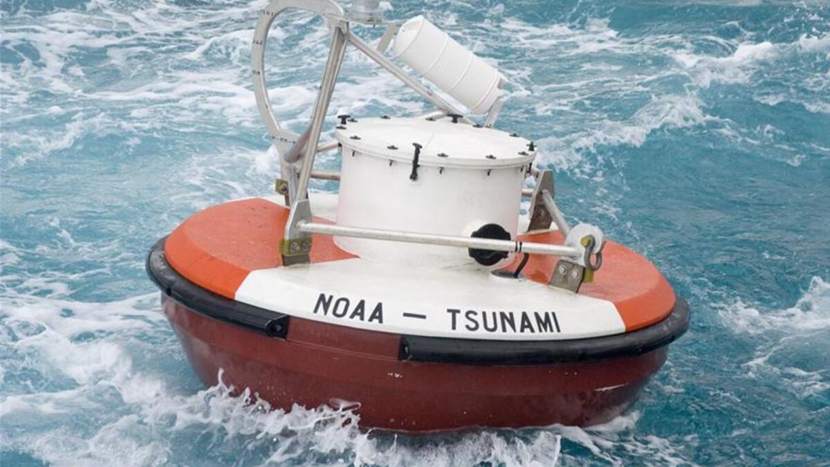
The tsunami sensing system operates on a simple premise: recording the tsunami as it races through the deep ocean, before it strikes the shore.
Officials long ago realized that simply relying on how big an earthquake is in the ocean cannot accurately predict a tsunami. Sometimes, big earthquakes produce no tsunami, and at other times, a moderate temblor might conjure up a tsunami surprise.
The solution developed by NOAA scientists was to send ships into the deep ocean and drop sensors that would sink to the sea floor, according to Bernard, a key architect of the system. The sensors would detect the tsunami as it rushed through, and then send signals to a connected floating buoy that would send data to the warning centers by satellite.
Concern across the West Coast
A document explaining the Trump administration’s plan acknowledged that “tough choices” were made to reduce funding, but “is necessary as we move toward a more efficient government that re-focuses on national security and core government functions.”
Members of Congress in both parties repeatedly have said they are more or less ignoring the administration’s budget recommendations in drawing up the bills to fund the government’s operations.
The administration’s suggested cuts, however, do illustrate how hard it is to fund government operations within proposed overall budget constraints. How to deal with those limits and whether to change them is currently a top issue on Capitol Hill.
The possible cuts to the tsunami network — as well as Trump’s plan to slash funding to an earthquake early warning system — have been met with concern by officials across the West Coast.
Once deep-ocean sensors are no longer maintained, the devices’ batteries would die in about two years, Bernard said. U.S. tsunami officials would have to return back to 1960s-era technology — relying on only earthquake sensors and shoreline tide gauges, which are far more inaccurate, Bernard said.
“It’s an absolutely reckless proposal,” said Rep.
‘Lives will be at risk’
A recent study found that accurate forecasts would help halve the number of people California would need to evacuate from a tsunami arriving from Chile, said Rick Wilson, tsunami scientist with the California Geological Survey. California would save $123 million in unneeded business closures.
Unnecessary evacuations can cause other problems. A big tsunami that might threaten San Diego Bay, home to a large naval base, would force authorities to make key decisions about how many ships they can safely get out of the harbor before it’s too late, said seismologist Lucy Jones.
Mass evacuations themselves can be dangerous, Jones said, and can cause traffic jams and major upheaval. “You don’t want to do it if you don’t have to,” she said.
Kevin Richards, natural hazards director for the state of Hawaii, said the reason people drowned in past tsunamis is because officials didn’t have technology to give precise warnings.
“You lessen that capability,” Richards said, “and yes, lives will be at risk again.”
Twitter: @ronlin
ALSO
Missing from President Trump's budget: Funds for California's earthquake early warning system
UPDATES:
8 a.m.: This article was updated with context about how members of Congress in both parties have said they are more or less ignoring the administration’s recommendations in drawing up bills to fund the government’s operations.
This article was originally published at 5 a.m.
Sign up for Essential California
The most important California stories and recommendations in your inbox every morning.
You may occasionally receive promotional content from the Los Angeles Times.


