
12 amazing L.A. hikes to try in 2025
- Share via
Los Angeles County provides vast opportunity for adventure. You can trek past Joshua trees in the Antelope Valley, tromp through snow in the San Gabriel Mountains and search for the best views of the ocean from the peaks near Malibu. And if you planned carefully, you could maybe do that all in one day.
But when is the best time of the year to take those adventures? I’ve got you covered. Here you’ll find a curated list of the best hikes to take for every month of the year. To select each hike, I considered the seasons and all that each one brings to L.A., whether that be waterfalls, wildflowers or winter weather.
Please remember to practice Leave No Trace while out enjoying our wild lands, leaving only footprints and taking only photographs. We want to leave the outdoors better than we found it for future generations to come.
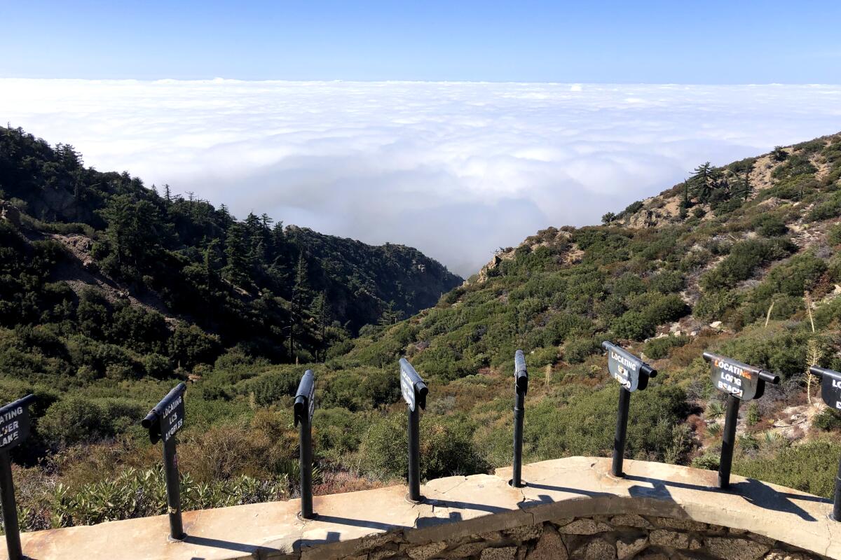
January: Inspiration Point
This out-and-back 10-mile trek takes you five miles into the San Gabriel Mountains, where you’ll discover a wooden pavilion with a large sign that reads “world famous telescope view.” Several metal spotting scopes sit perched in front of the shelter, pointing toward Seal Beach, Silver Lake, Glendale and more. On a clear day, you can spot Catalina Island, which the sign advertises is 75 miles away.
The trail climbs 2½ miles to Echo Mountain, the site of a one-time resort hotel and railway that welcomed visitors during L.A.’s great hiking era from the 1880s to the 1930s. Only ruins are left. This is roughly the halfway point and a good turnaround spot if your legs are getting weary.
Otherwise, from there, make a loop by going up the Sam Merrill Trail and down the steep but beautiful Castle Canyon. Inspiring? Let’s hope! Otherwise, it’ll provide you enough endorphins to at least leave a little happier than you came.
Park on the street and start at the end of Lake Avenue in Altadena. Directions to trailhead.
February: Mount Lukens via Haines Canyon
Your journey will begin through Haines Canyon, a popular spot for hikers and mountain bikers alike. You’ll hustle past the Haines Debris Basin, where you might spot people fishing. About a mile in, you’ll come to a fork in the trail. I’d recommend taking a left, heading north (or clockwise).
This western side of the trail is forested and gets far less sun, and thus, under the right weather conditions, you’ll find snow. Not enough to necessitate crampons, but trekking poles — and sometimes even micro spikes — are recommended. You’ll hike past a blue Volkswagen Beetle of unknown origin and, three miles in, arrive at another fork.
If you’d like to continue to Mt. Lukens, you’ll head east and hike for another two miles to the top. The peak is a bit lackluster, as it features telecommunications towers, but it does provide nice views. If you skip the summit and turn west, you’ll shave four miles off your hike and trek along the more exposed side of the mountain, where you’ll find native plants and great views. Either way, hopefully there will be enough powder to make a snowball and chuck it at your hiking partner!
Be careful when parking and heed any parking restrictions, including several “No Parking” signs on Haines Canyon Avenue. Consider the walk from your vehicle to the trailhead your warmup.
March: Mount Hillyer via the Silver Moccasin Trail
Hiking this trail in March, you might spot some snow, as Mt. Hillyer is at about 6,170 feet — high enough to get a nice dusting of powder should winter storms pass through the region.
If taking the trail counterclockwise, you’ll pass the Bandido Group Campground about 1.5 miles in. It has a few vault toilets. If you’re lucky, you’ll be greeted by horses, as this campground has several corrals. Keep an eye out for Jeffrey pines, which provide shade around the site. From here, the trail is paved until you reach the Rosenita Saddle. You’ll soon encounter tall ponderosa and sugar pines.
The trail also features Coulter pines that produce massive cones nicknamed “widowmakers” because of their size. The Coulter pine cones can weigh up to 11 pounds! Being struck by one would be like getting hit in the head by a spiny house cat. So, if you’re in the area when it’s windy, please watch your head.
To reach Mt. Hillyer, you’ll turn left about three miles in. The summit features several boulders that are a blast to scramble along. It’s a great spot to pause for lunch, one where you have a view of dense forest and other peaks, including Santiago Peak, the highest point in Orange County.
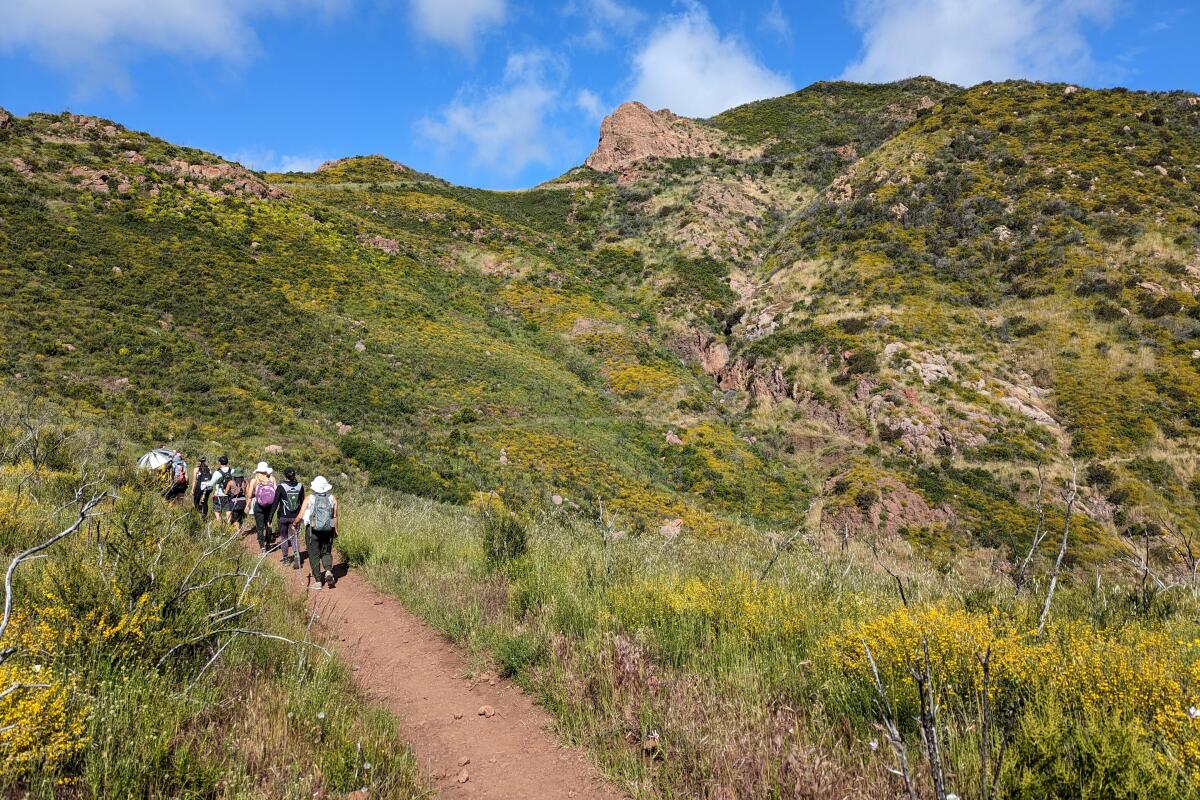
April: Sandstone Peak
There are plenty of ways to enjoy Sandstone, but for a more gradual ascent and the most rewarding scenery, take the classic Mishe Mokwa loop. As you ascend, views of the dramatic sandstone Echo Cliffs over a ravine draw you in (you may see rock climbers scaling the walls — it’s a popular spot, with more than 200 routes). You’ll also find two popular geological sites: Balanced Rock, a wicked rock formation that seems to be truly defying gravity, and Split Rock, where you’ll often witness hikers trying to squeeze through the cracks. Continuing on, you’ll run into Tri-Peaks, a summit with a rocky outcropping (which can be tacked onto your hike via a quick 1-mile out-and-back if you’re craving more), and another short spur trail that leads you to a different Inspiration Point than the peak listed in our January hike.
Continue onto Sandstone and find incredible views, a rock that makes for a perfect picnic spot and a plaque honoring W. Herbert Allen, who donated many acres of land, including nearby Circle X Ranch. (Mt. Allen is Sandstone Peak’s alternate name — in the 1960s, the Boy Scouts tried to change the name officially, but Allen was still alive at the time, and a policy prohibited naming geological features after a living person.) Enjoy the view — at 3,111 feet, you’ve made it to the tallest peak in the Santa Monica Mountains.
Park in the dirt Sandstone Peak trailhead lot just off Yerba Buena Road, east of Circle X Ranch. Directions to trailhead.
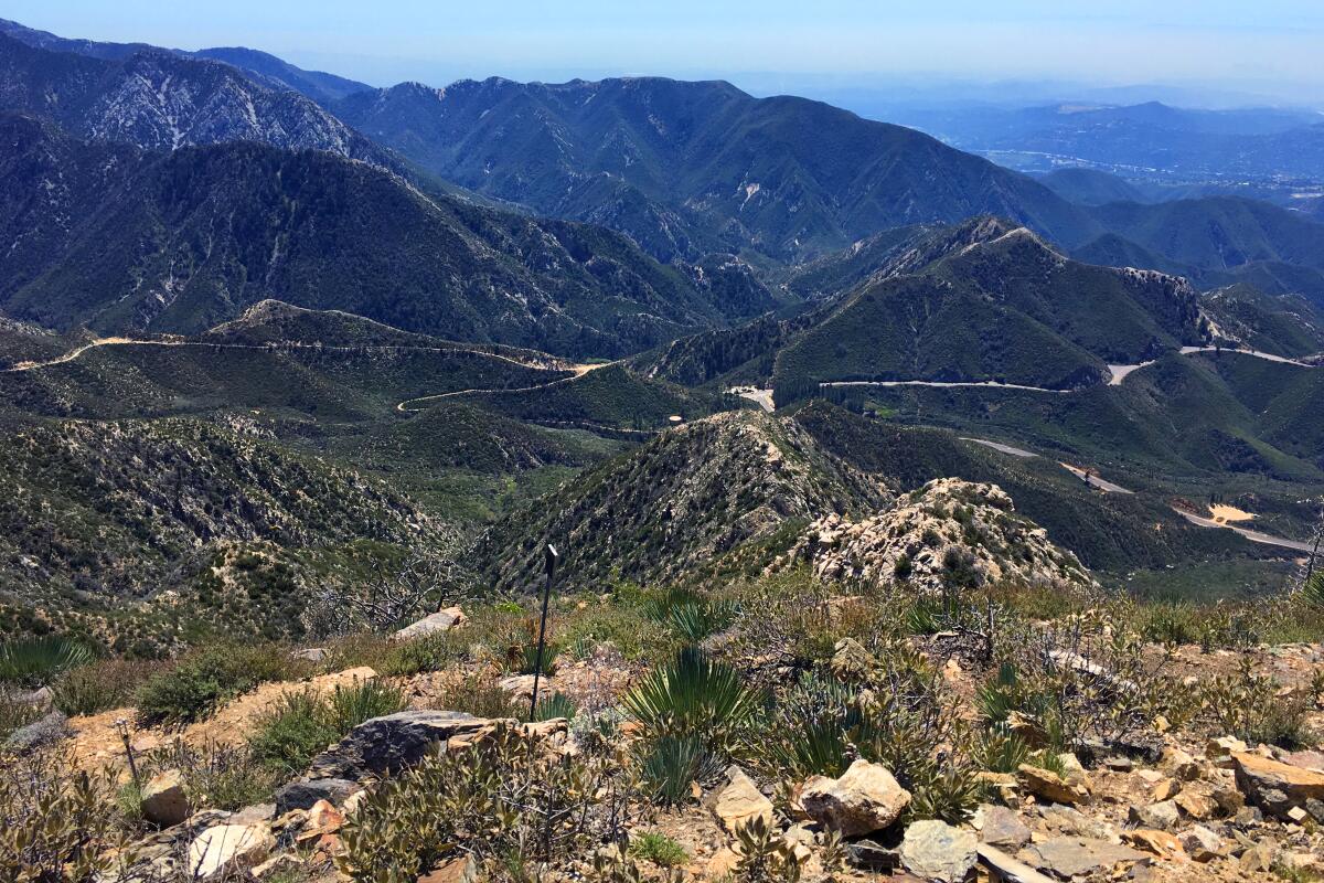
May: Strawberry Peak
Hiking it in May, consider bringing a themed treat. Snag some fresh strawberry doughnuts from the Donut Man or splurge at your farmers market on Harry’s Berries. (You’re worth it.)
The trail starts gently and then comes to a long saddle. The goat trail on the left starts steeply down before heading upward, at times on slippery loose dirt and scree.
You’ll come to what you think is the top, but it’s a false summit. Press on. Eventually, you’ll arrive at the rocky actual top. Pause and enjoy the well-earned views of the Arroyo Seco and Big Tujunga watersheds.
Start at Red Box, almost seven miles north of La Cañada Flintridge on Angeles Crest Highway (California 2). Directions to trailhead.
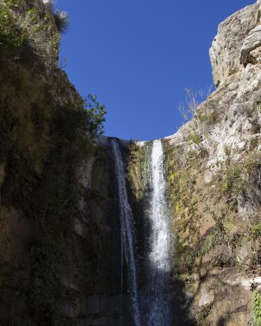
June: Trail Canyon Falls
The hike can be divided into two parts. The first is a relatively gradual ascent through a forested area with plenty of shade. You’ll have to navigate about 10 creek crossings, which after rain can be challenging if you struggle with balance issues.
One tip: Rather than taking a precarious route across the water on slippery rocks or a jiggly log so as to keep your feet from getting wet, consider plunging your feet into the cool water, shoes and all, and walk across the mostly flat, muddy creek base. (Still, be mindful of rocks.) On a hot day, it’s quite pleasant, not to mention safer.
The second part of the hike is straight up and without any shade whatsoever. Bring sunscreen, plenty of water and a hat.
This hike gets crowded on weekends. But considering the many creek crossings, it’s helpful to run into fellow hikers who can assist you over the water. Aren’t the friends you meet on the trail part of the hiking experience?
The 30-foot waterfall at the end of the journey is worth the trek. Enjoy views of it from the peak or, for those who don’t get vertigo, descend the last part of the trail — mostly on rocks — with the help of built-in ropes, the condition of which we can’t confirm, as it may vary over time. Descend at your own risk. It’s quite steep but will take you to the base of the waterfall, where you can wade in the water.
Additional tips: Buy a $5 National Forest Daily Adventure Pass online, from any San Bernardino National Forest Office or at an affiliated vendor, such as Big 5, and leave it in your car after you park (along the side of the road). Watch out for poison oak, as it’s bountiful on this hike. Also consider bringing along a towel and an extra pair of shoes and socks to leave in your car. Your wet feet will appreciate it afterward.
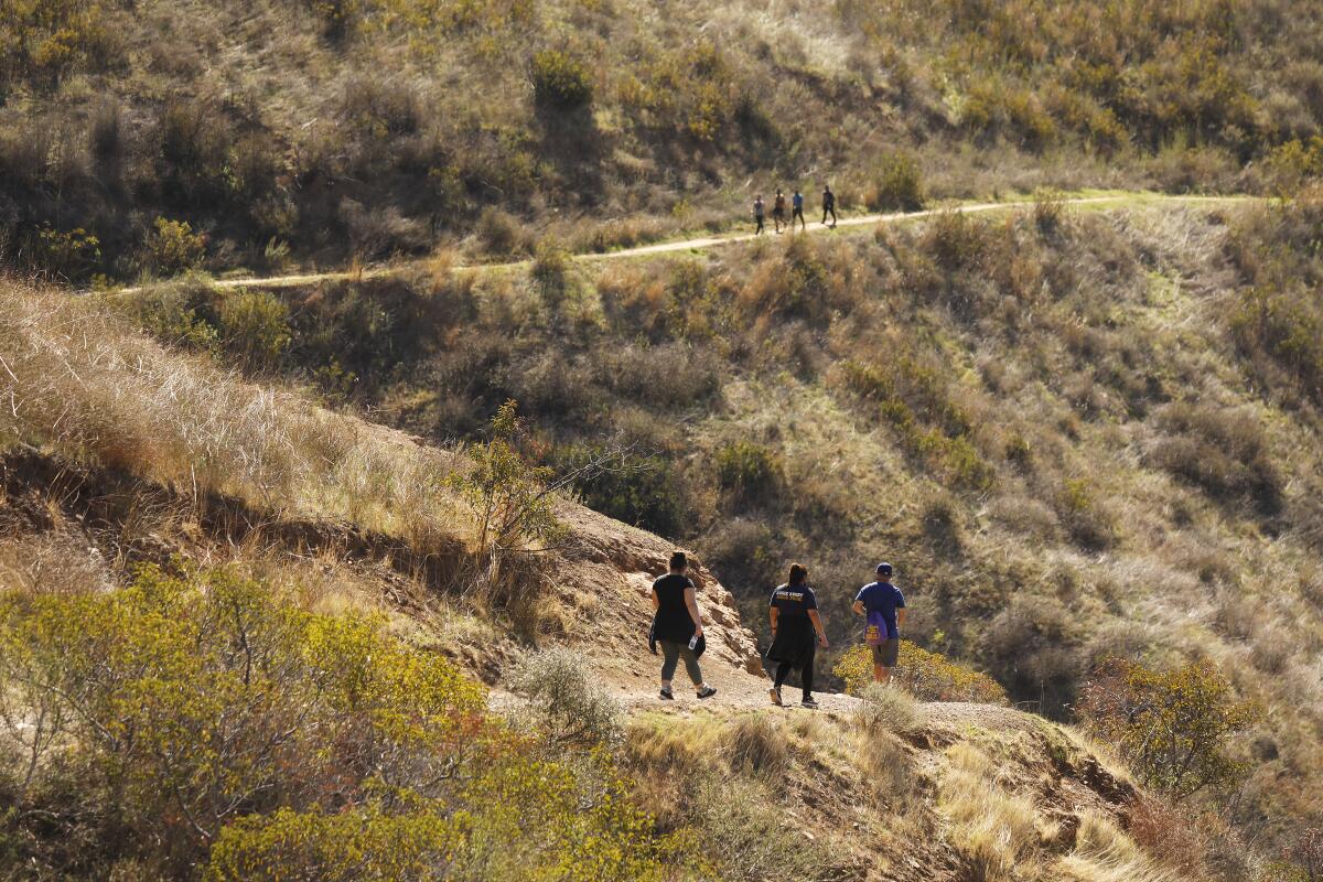
July: Solstice Canyon
The hike gets high marks for a small waterfall (which may or may not be flowing in July) and the ruins of Roberts Ranch, which belonged to the successful grocery-chain operator Fred Roberts. The brick fireplace, foundation and other fragments of the midcentury home remain. It was designed in 1952 by Black architect Paul Revere Williams, who also created the futuristic Theme Building at Los Angeles International Airport and designed much of the remodeled Beverly Hills Hotel.
Start up the Rising Sun Trail that winds through sycamores, oaks and alders, walk the loop at the top and then descend on the main road.
Park and start at Solstice Canyon park entrance in Malibu. Directions to trailhead.

August: Fish Canyon Narrows
You’ll park on the road’s shoulder, cross through a gate and walk down the roadway before reaching a dirt path. The trail will split, and you will head east along the dirt path shaded by sycamore trees and northeast over multiple water crossings. You’ll have the chance to spot multiple small waterfalls along the way.
The narrows are often cooler than the rest of the area. That said, this trail can get hot in the summer, really hot in August, so it’s best to go early, especially if you’re hiking with a dog. The ground, specifically the roadway at the trail’s start and any exposed path, will get hot enough here to burn their paws. So, again, come early or leave them at home with your air conditioning.
Your hiking app might suggest you continue past the narrows up the dirt road. This trail technically ends at a decommissioned campground, but at times it is so overgrown and covered in poison oak that I’d recommend just stopping in the narrows to rest, eat and enjoy nature. Also, be mindful of where you walk, as the ground and concrete around the narrows are washed out in areas, and there is some exposed rebar.
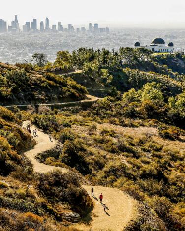
September: Mt. Hollywood
Views from the top start at Griffith Observatory below and then sweep west from downtown L.A. to Hollywood, Century City and the ocean, when there’s no haze or fog. Along the way, you’ll pass by the Berlin Forest, a pine sanctuary dedicated to L.A.’s German sister city, and Captain’s Roost, the original site for Dante’s Garden.
At night, the panorama changes to a carpet of twinkling lights. Griffith J. Griffith donated the land to the city in 1896 as “a resort for the rank and file, for the plain people.” There are plenty of routes to this peak, but for a full moon hike, it’s best to park near the merry-go-round, because that parking lot stays open after dark.
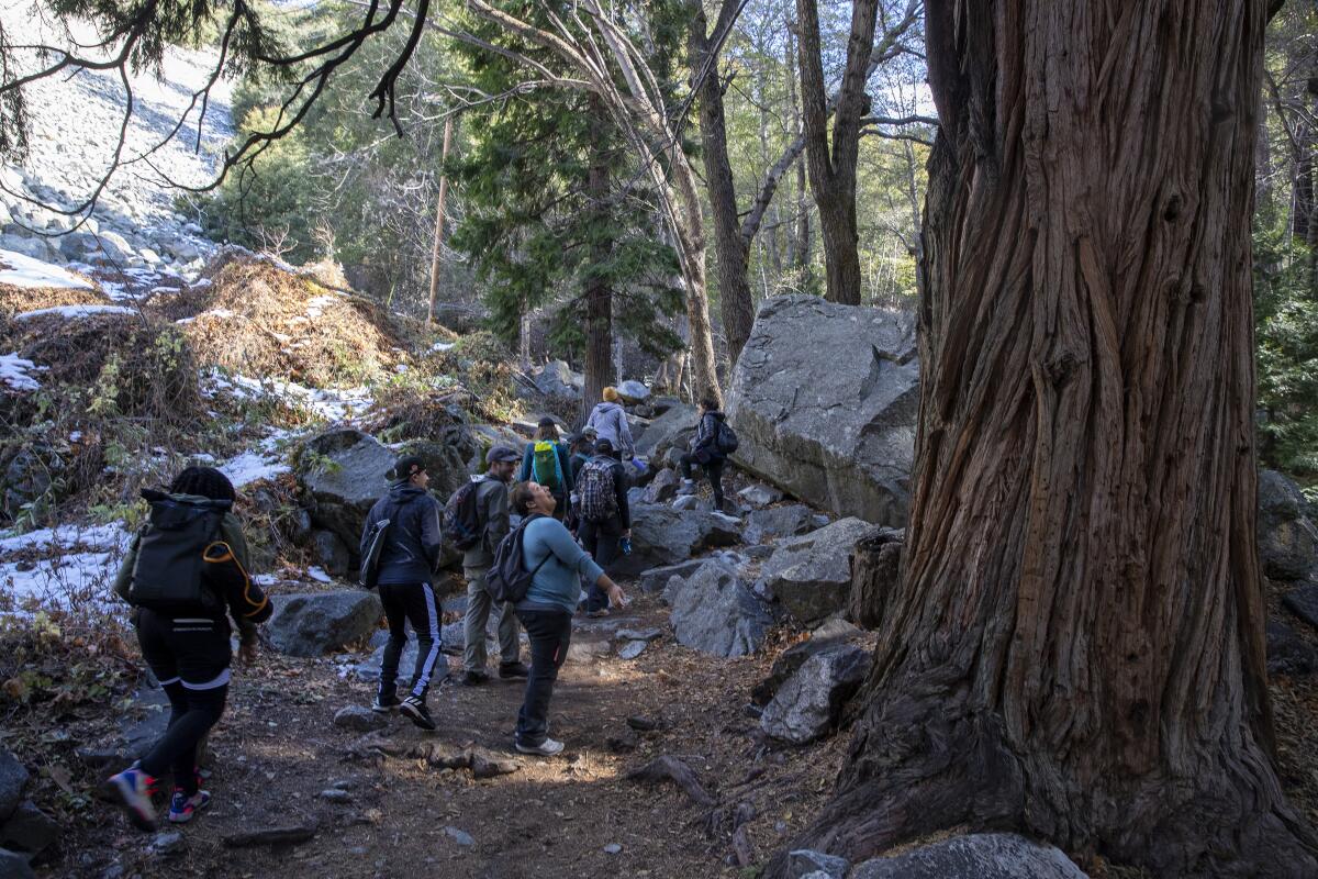
October: Icehouse Saddle via Icehouse Canyon
In October, if temperatures have dropped low enough, you will hopefully find fall foliage as the leaves of native trees start to change. There could be snow, so make sure to pack your hiking poles and micro spikes, just in case.
Take the main Icehouse Canyon Trail that starts along a tree-lined creek. Stop anywhere along the way to take a break by the water; you may not want to leave.
The trail pushes on past rustic cabins and, in spring and summer, columbine and scarlet monkey flowers bloom at watery seeps. You’re hiking uphill the whole time. Halfway up, long switchbacks require serious leg work as the trail zigzags toward the saddle at 7,500 feet. Pull up a log, bask in the shade and have lunch or a snack.
For those who want to hike longer and higher, continue from the saddle on well-marked routes to Ontario, Cucamonga and Timber (shown in the photo above) peaks. On the way down, stop at the creek to double down on the cool factor. One caveat: Parking is brutal on weekends. When the lot is full, you’ll have to find a spot on the narrow Mt. Baldy Road. Also, an Adventure Pass ($5) or annual pass ($80) is required.

November: The Devil's Chair
The first mile of this hike is arguably the hardest part, as you gain 500 feet in a mile.
After the first mile, you’ll find a creek that, as of early November of last year, was still flowing. As you hike along the trail, you’ll probably spot chipmunks and gray squirrels and hear a variety of birds, including hawks, ravens, white-crowned sparrows and dark-eyed juncos (which are very cute).
You will see several burned and dead trees. This area is still recovering from the 2020 Bobcat fire. Avoid it on especially windy days so as to not to be hit over the head, or worse, by a crispy trunk. Occasionally, you might see the scant remains of pinyon pine. But despite the burn areas, this trail is still so worth it. There are so many different rock formations — orange, purple, green and gray — to see.
The end of the hike feels like a safer version of Angels Landing in Zion National Park. You will walk a narrow fenced path to a small boulder, surrounded by a short fence, that overlooks the valley. From your perch, you can listen to the whistling wind as you take in a panoramic view of massive rock formations below. If you’re lucky, you might spot bighorn sheep, which like to hang out in the cavern below. Watch where you step along this last part of the trail, as there are some holes in the bottom of the fence. Drop your cellphone here, and it’s gone.
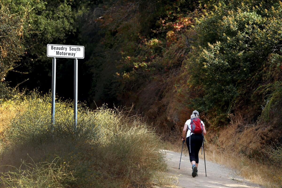
December: Beaudry Loop
The trail slowly reveals views of more of the mountain range between Glendale and Burbank and the neighborhoods that sprang up below. In December, these views have hopefully been made even clearer by winter rains. Plus, given how exposed this trail is, it is great to hike in winter instead of summer, when it’s much too hot.
At the intersection with a north and south loop, go either way to 2,656-foot Tongva Peak, named for the Native Americans who thrived in the local mountains. Take a break at the top and marvel at how wild this spot feels despite the urban clutter below. Complete the loop and you’re done.
Park on the road and start at Beaudry Boulevard off Country Club Drive in Glendale. Directions to trailhead.
Sign up for The Wild
We’ll help you find the best places to hike, bike and run, as well as the perfect silent spots for meditation and yoga.
You may occasionally receive promotional content from the Los Angeles Times.


